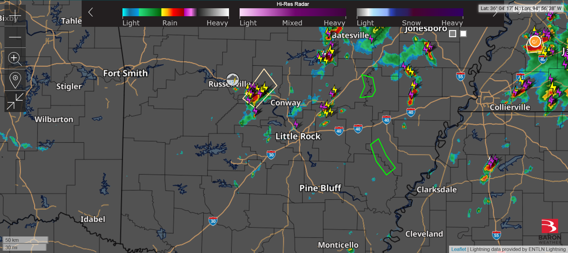
There continues to be scattered showers and thunderstorms across Arkansas today. Most of these are not severe, but are providing some useful rainfall. If the situation becomes severe, I will update here.
from Nathan Parker; Hot Springs, Arkansas
There continues to be scattered showers and thunderstorms across Arkansas today. Most of these are not severe, but are providing some useful rainfall. If the situation becomes severe, I will update here.
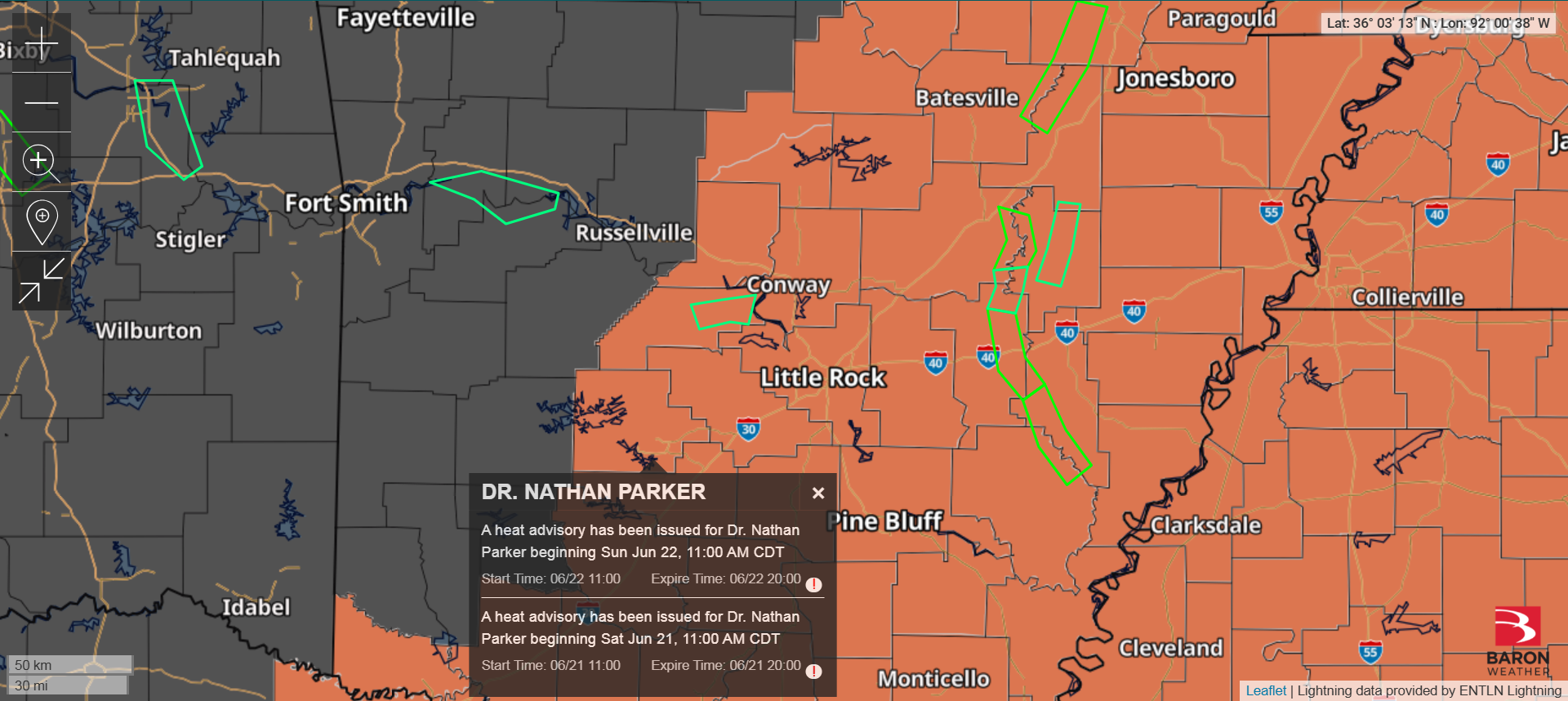
We’re under a heat advisory this afternoon. I expect to see more of these all summer long.
Finally, all of my weather reports are free and will always be free, but I’ve been occasionally asked if there’s a way to setup a virtual “tip jar” as a thank you for my posting these weather reports. So I’ve created a link to the service Buy My a Coffee (although since I don’t often drink coffee, I’m naming my link “Buy Me a Chicken Sandwich“) to act as a virtual “tip jar” for anyone who wishes to “tip” me for providing these weather reports to the community.

Half inch to 1″ hail possible.
Tornado Watch for much of Arkansas. Here’s a radar update.

Severe Thunderstorm Watch. Here’s a radar update.

Severe Thunderstorm Warning for Garland County. Here’s a radar map plus a look at the hail and flooding potentials for the storm.


Tornado Watch for part of Arkansas (including Garland County). Here’s a radar update.

Slight risk of severe storms for Hot Springs today. Here’s a look at the SPC Outlook, a current high-res radar check, and FutureCast at 7PM tonight.
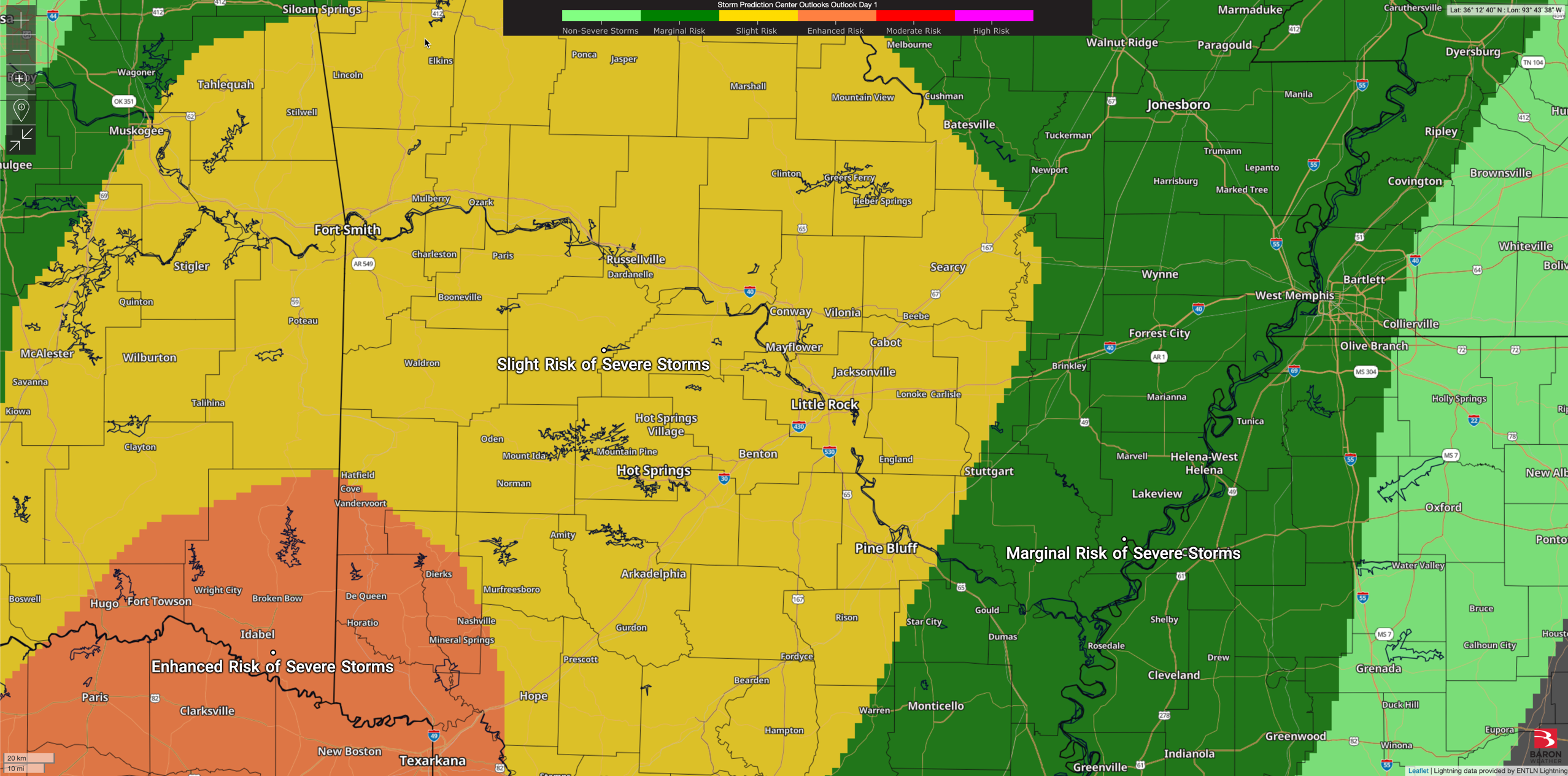


There’s a low (marginal) severe risk for Hot Springs today. Here’s also a radar update with the regional radar and satellite.


Her’s the last Severe Risk from the SPC, plus the latest high-res radar update. Here’s also the Baron FutureCast showing the storm at 4PM moving through Garland County.


