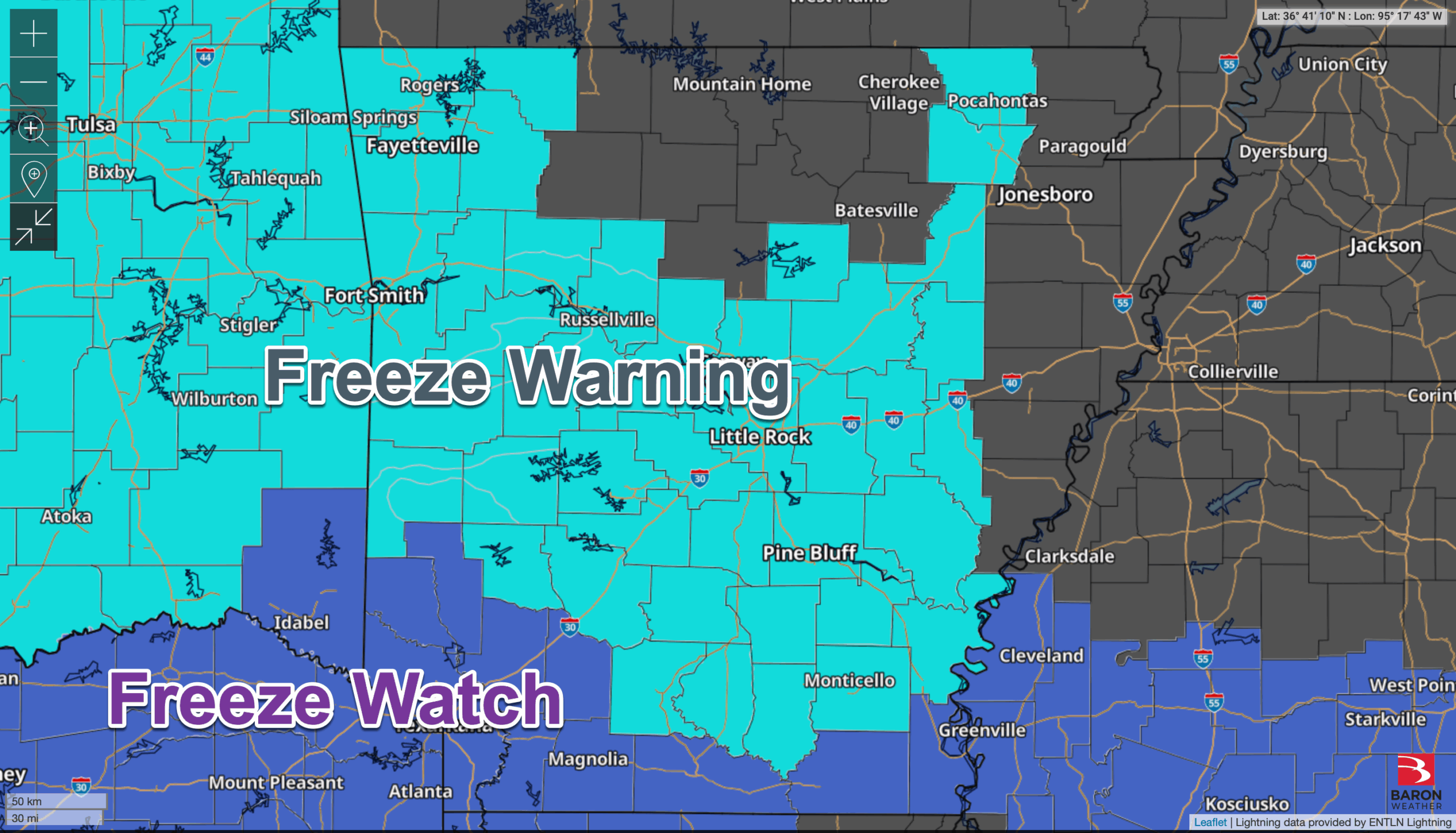
Freeze Warning for much of the state. Other parts of the state are under a Freeze Watch.
from Nathan Parker; Hot Springs, Arkansas
Freeze Warning for much of the state. Other parts of the state are under a Freeze Watch.
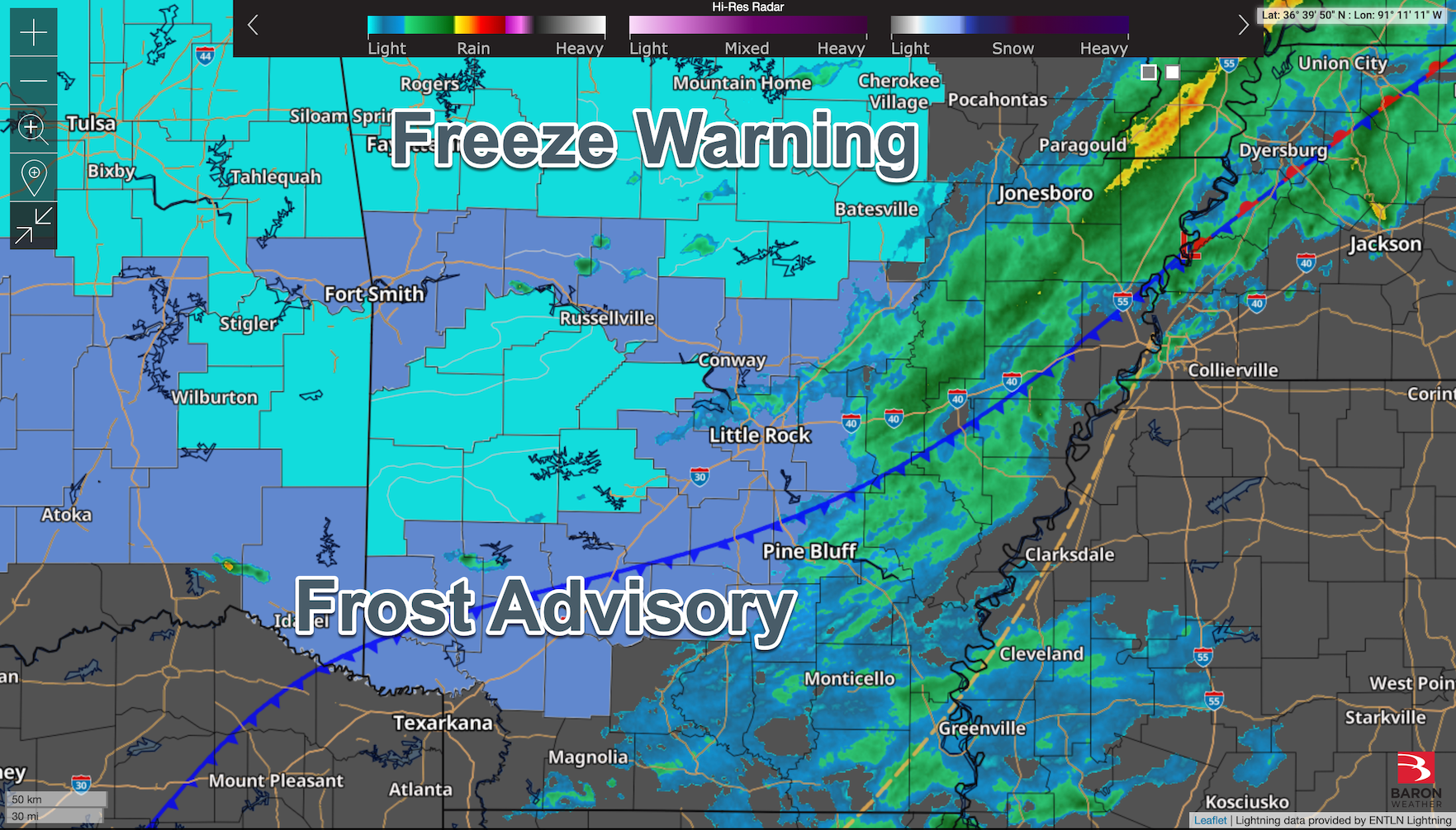
Parts of the state are under a Freeze Warning, and others are under a Frost Advisory. There are also some scattered showers across the state. Here’s the latest look at high-res radar, plus showing where the cold front is located.
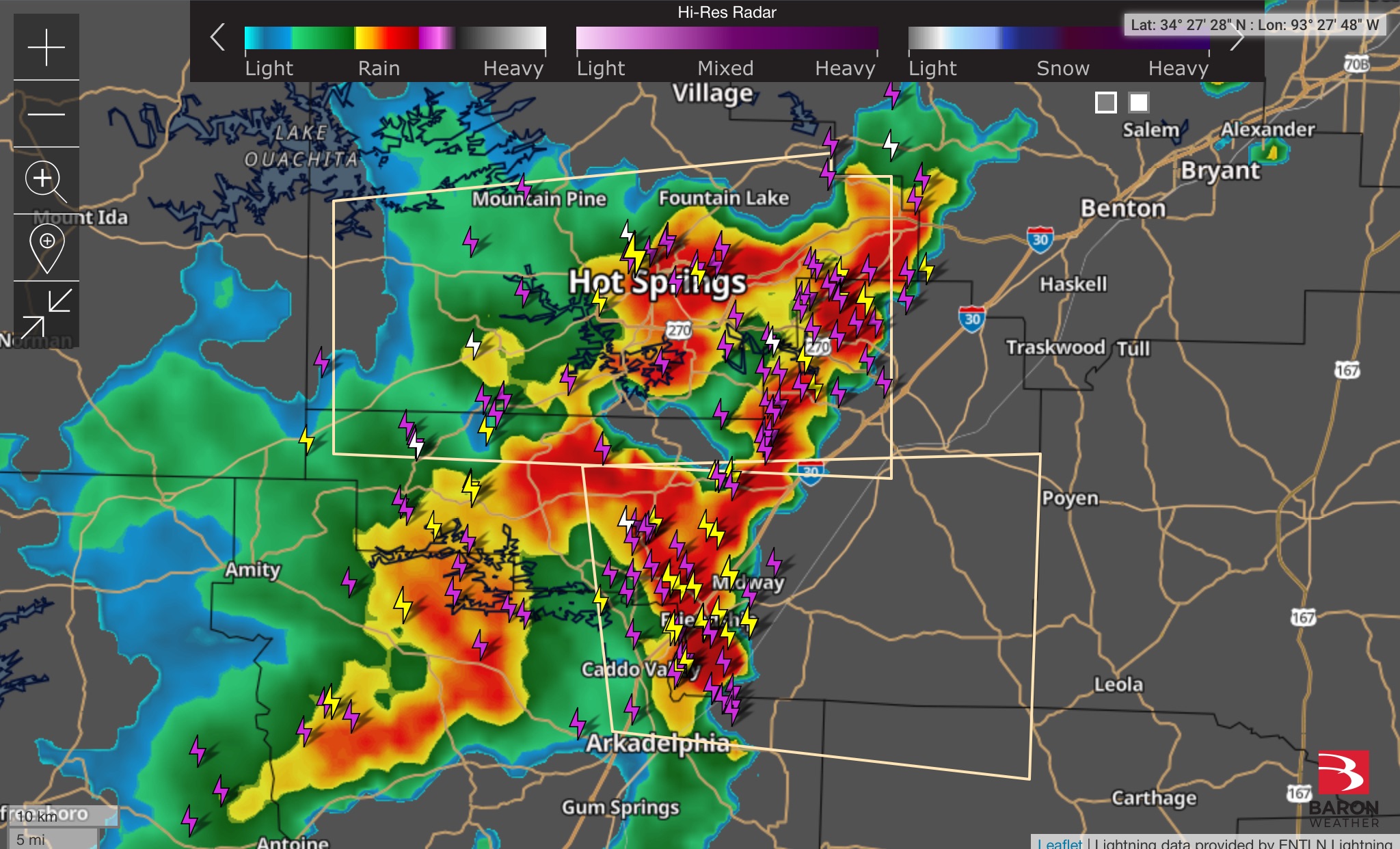
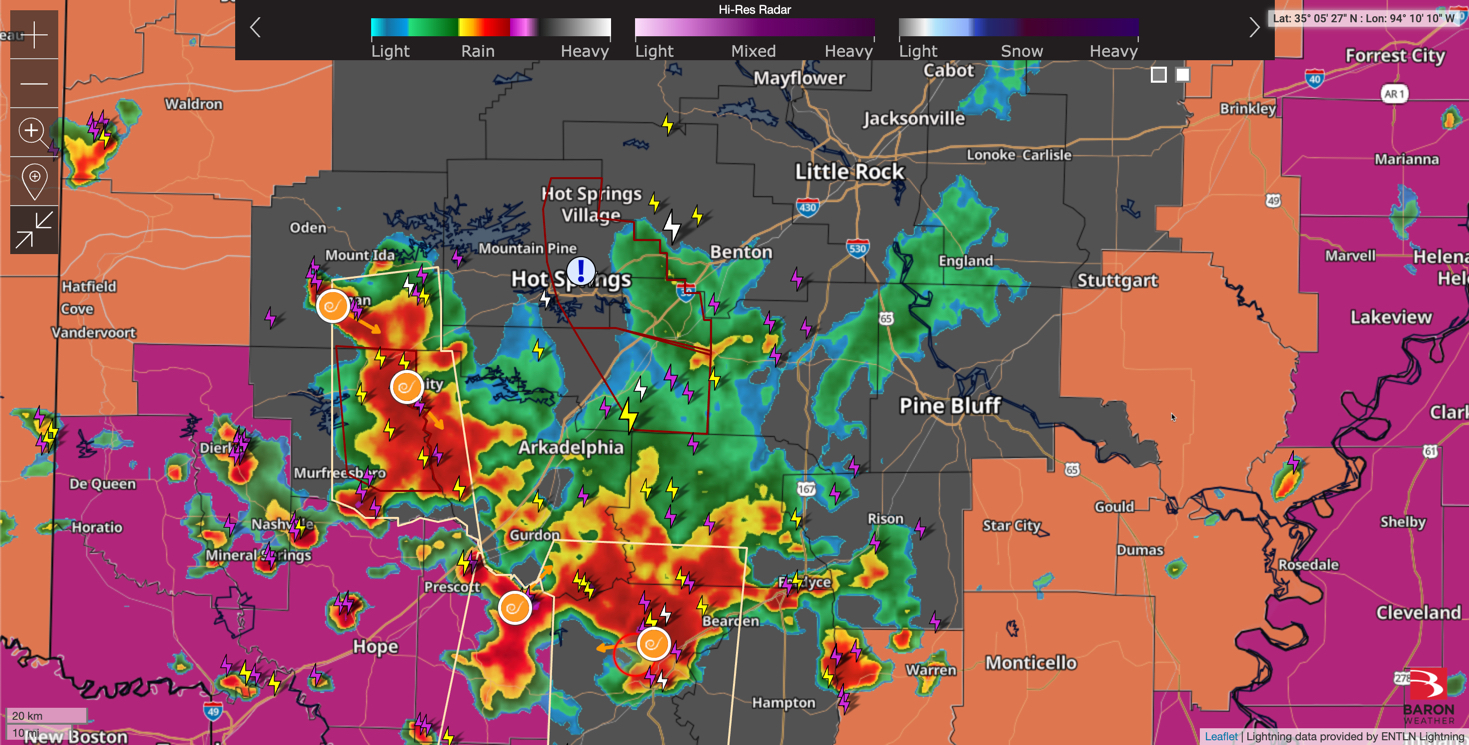
Part of Garland County is under a Tornado Warning, but most of the Hot Springs area is not. Part of Clark and Hot Spring county is in there. For those in the warning area, take cover immediately!
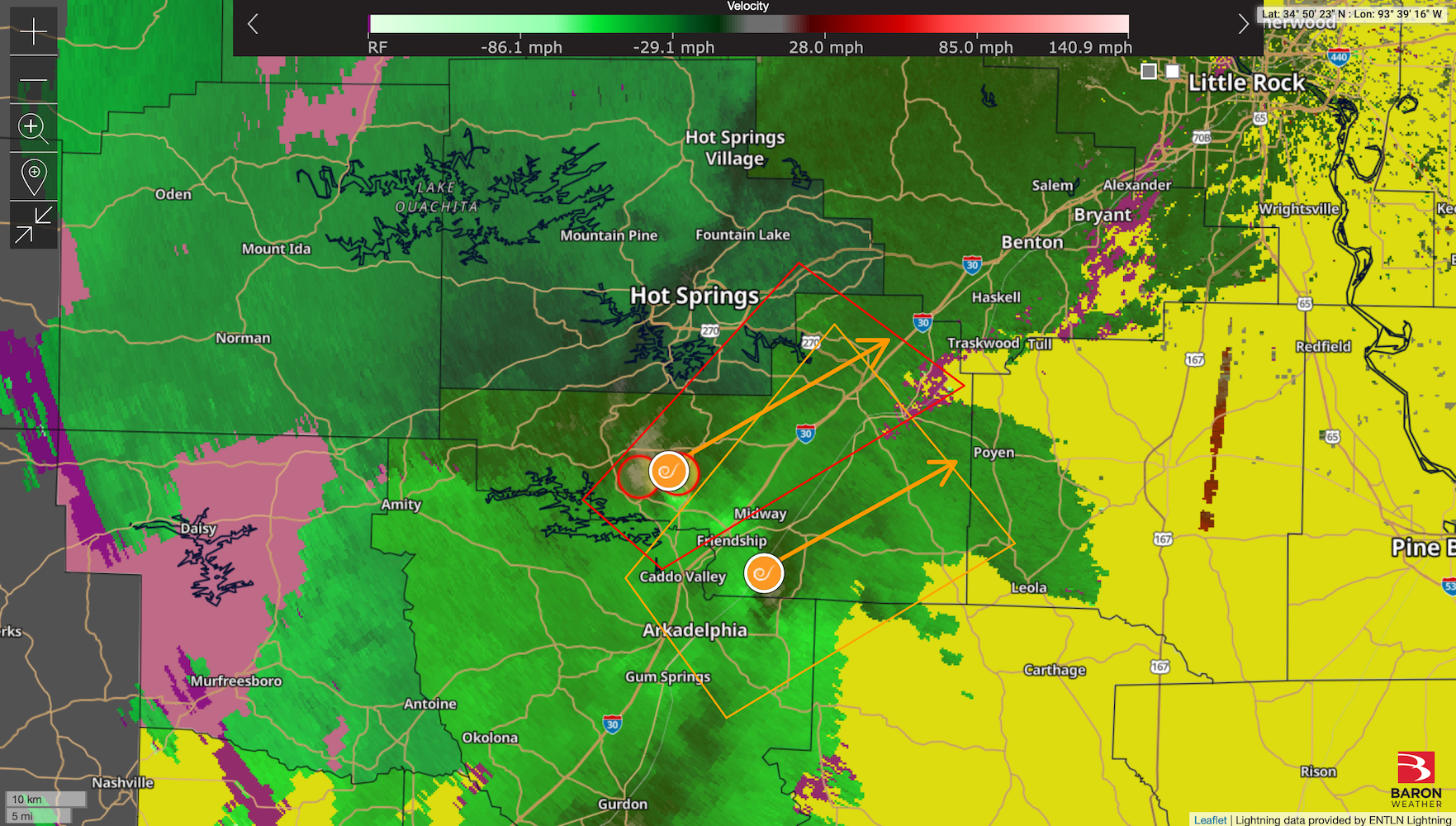
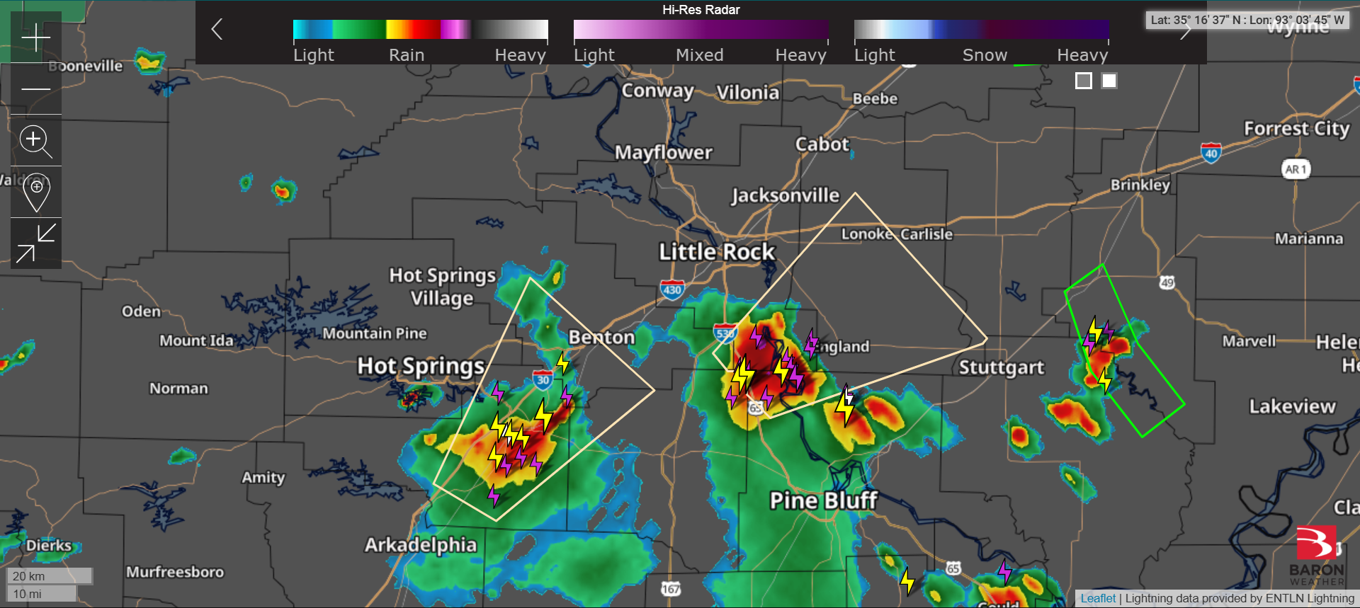
Severe Thunderstorm Watch (red) for Garland County and part of Arkansas. Another part of Arkansas is under a Tornado Watch (yellow). Here’s the latest high-res radar update.
To ensure rumors and inaccurate information will not be spread concerning this recent incident, I wish to make a formal PSA on my newsletter and weather blogs.
I am no longer doing consulting work for Earth Networks/Davis Instruments/AEM. This week, AEM (Earth Networks and Davis Instruments’ parent company) terminated their consulting agreement with me, effective at the end of the month, but I am no longer involved in further work but am winding down operations (I don’t even have access to my company email or logins or company-issued computer).
I have been working for Earth Networks (when it was known as AWS/WeatherBug) for about twenty years (since I was a teenager). Originally I was an internal employee/intern with them, but I was moved to an outside IT consultant when WeatherBug had planned to launch the “WeatherBug Home”/SmartThings partnership since they needed to reimburse me for the SmartThings equipment I would be testing for them, and that required me to work as an outside IT consultant for them instead of an internal employee. When the WeatherBug brand was sold to xAd/GroundTruth, I stayed on at the “mother ship” (Earth Networks) as an IT consultant, handling activities such as producing webinars (including training government agencies leading to major upsells for the company), screencast videos, product documentation/manuals, and for a while, I’ve been handling front-line email support for Davis Instruments, dramatically speeding up the response time of their email support.
Long-term, I will be in a better position moving forward. While I had started out with AWS/WeatherBug/Earth Networks at a low pay as a teenager and intern, I continued to receive below-minimum-wage payment from the client even post-graduation from my Master’s and PhD programs (while the company was securing massive contracts and paying colleagues I would work with “in the trenches” substantially more). Coupled with handing outstanding/late invoices each month from the client, as well as the client gradually attempting to transition the relationship from a consultant/client relationship to functioning as an employer/employee relationship outside the bounds of the consultant agreement (conflicting with with my current, full-time employment), the situation would have impacted my physical and spiritual health long-term. While my consulting services attempted to restore the consultant/client relationship with the client, the client decided to terminate the agreement and part ways with my consulting services instead of restoring the previous relationship.
Moving forward, this will place me in a better position to work with companies either as a consultant or an employee in a position and salary more aligned with my degree and with better overall structure and better for my overall health and wellbeing. I had a long road and accumulated about twenty years of work experience and product knowledge during my time at Earth Networks/Davis Instruments/AEM. I had an opportunity to work alongside some great colleagues (I unfortunately did not have the opportunity to say goodbye to any of my current colleagues!) and serve a wealth of customers over the years. I am doing well financially as I am employed full-time with Accordance Bible Software and will be focusing all of my efforts on my work at Accordance. With that said, I am also in a position where I can take on some part-time side work as a consultant or part-time employee for another organization who would make use of my talent and services while continuing to serve Accordance’s family of customers full-time. You can learn more about me and see my resume and academic CV at my website at parkernathan.com, as well as follow me there to see what the next chapter will be in my life. I will continue to write for my newsletter and write weekly weather reports for my weather blog (although I will have access to a little less weather data moving forward). I will no longer be able to keep my current Earth Networks/Davis weather equipment and HD Camera online, but I do have an on-site Tempest weather station and PurpleAir air quality sensor I will be keeping online.
In the meantime, if you are grateful for the work I did serving you over the years, feel free to purchase my PhD dissertation, shop on my Patreon shop or Buy Me a Chicken Sandwich page, purchase or stream my Christmas album, or become a paid subscriber of my newsletter on Substack or Patreon.
I want to thank all of the customers I had the privilege and honor of serving over the years I worked for Earth Networks/Davis Instruments/AEM and for the colleagues I served alongside over the years during my time there. I am excited to see what the Lord has in store next for me in this next chapter of my life!
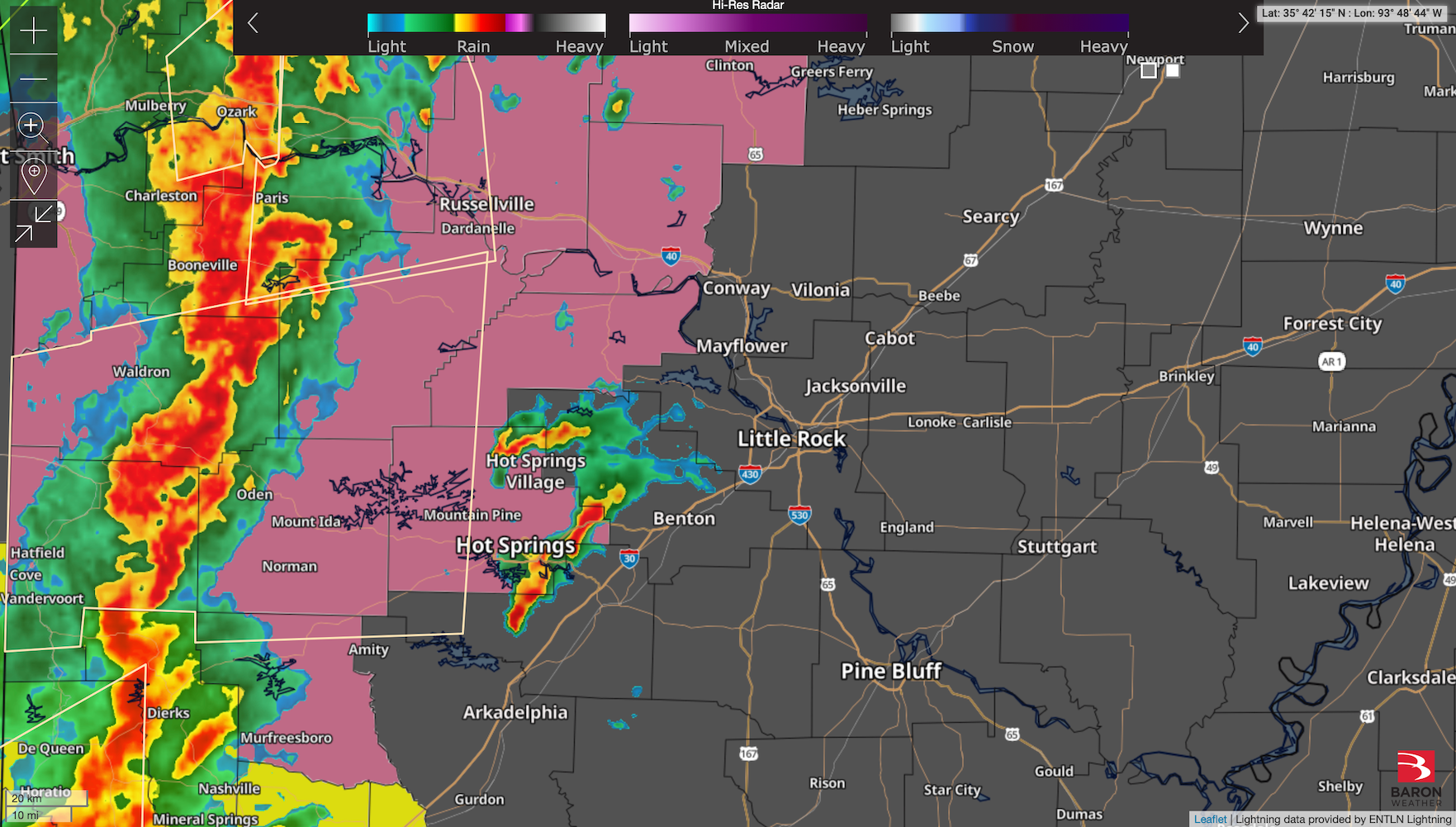
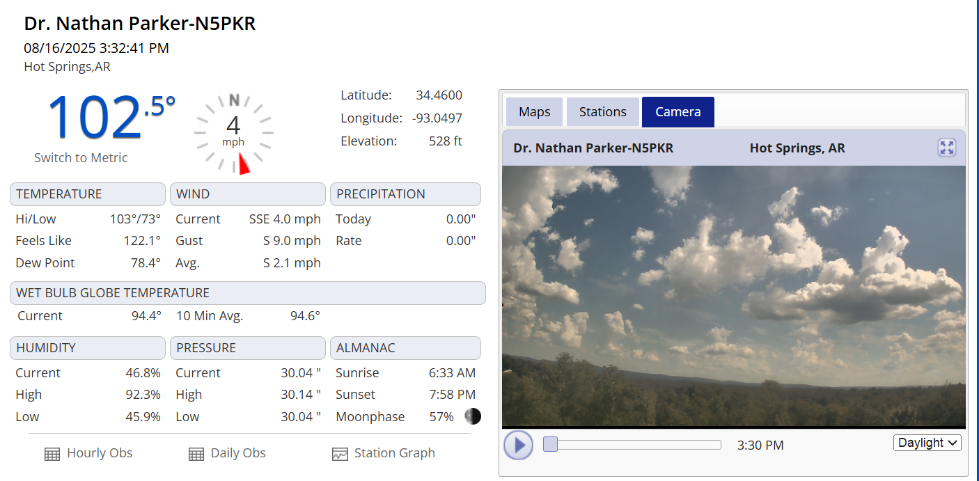
We’re under a heat advisory this afternoon, plus there are a few random showers across the state. Here’s a look at the current high-res radar, plus 102 outside on my weather station! Awful!
Heat Advisory is back for today. South Arkansas is also seeing some showers. Here’s a look at the current high-res radar.
Scattered storms bringing much-needed rain and relief from the temperatures are continuing to occur this afternoon.
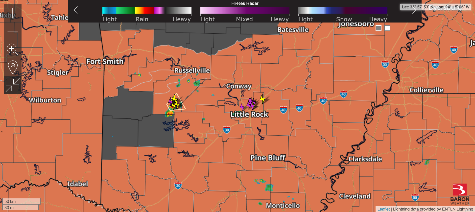
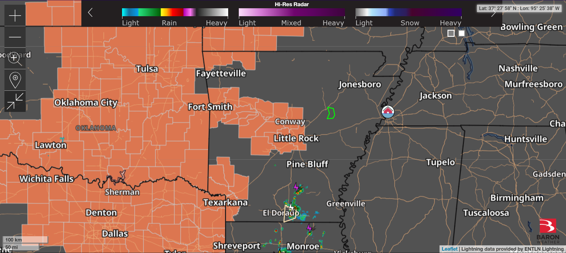
There are some showers and thunderstorms across Arkansas this afternoon. Here’s a look at the current high-res radar.