Two storms near Hot Springs, but so far the Lake Hamilton area has been right in between them. Here’s a look at the current high-res radar and Severe Threats map.


from Nathan Parker; Hot Springs, Arkansas
Two storms near Hot Springs, but so far the Lake Hamilton area has been right in between them. Here’s a look at the current high-res radar and Severe Threats map.


Going to be a windy afternoon today! There’s a wind advisory in affect, plus here’s a look at FutureCast Wind Gusts.


A thunderstorm with some potential hail is in the way to Hot Springs. I’m continuing to monitor it.


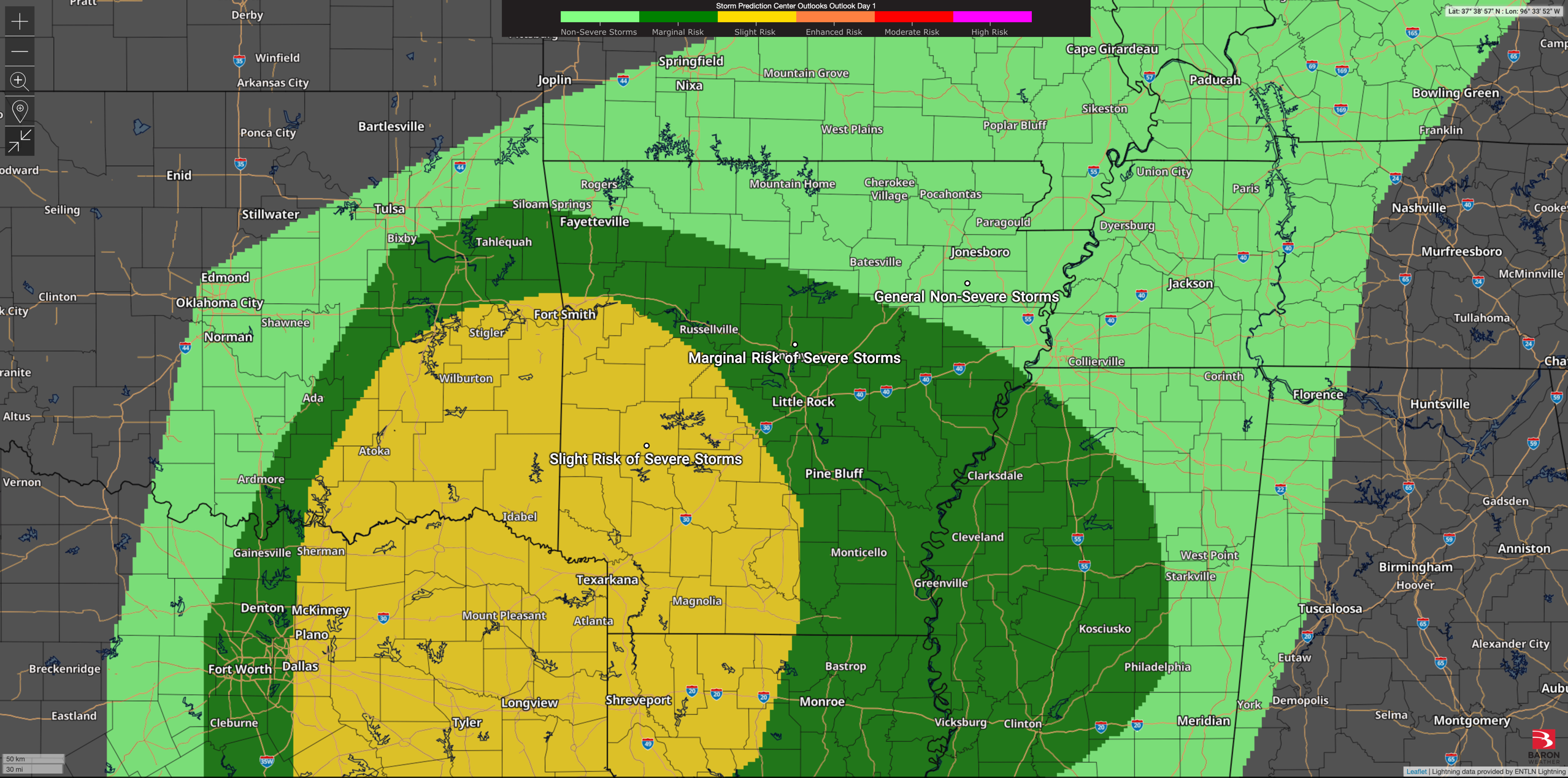
Slight Severe Risk tonight for Garland County. 15% on the SPC Outlook for Hail. I’ll continue to monitor the severe weather situation tonight.


There will be plenty of rain today and the occasional possible thunderstorm, but today’s weather event will not be severe for Central Arkansas. Here’s a look at the current high-res radar and SPC Outlook for today.


Hot Springs and much of Central Arkansas is under an Enhanced Risk for Severe Weather Tuesday.

The FutureCast models have updated to now put the timing around 10-11 AM for Hot Springs/Garland County.


Today, most of the state is under a Wind Advisory. Expect high winds throughout the day.


The National Weather Service is pleased to announce that the week of March 2nd – March 8th has been designated as Arkansas’ Severe Weather Awareness Week. This annual event is aimed at increasing public awareness about the dangers of severe weather and encouraging people to take steps to protect themselves and their property.
During the week-long event, the National Weather Service Offices covering the state of Arkansas will be covering various aspects of thunderstorm hazards that can cause property damage or place people in danger. Each day will focus on a different topic, including:
Sunday, March 2, 2025: Introduction to Severe Weather Awareness Week
Monday, March 3, 2025: Flooding
Tuesday, March 4, 2025: Lightning
Wednesday, March 5, 2025: Tornadoes
Thursday, March 6, 2025: Severe Thunderstorms
Friday, March 7, 2025: Watches and Warnings
Saturday, March 8, 2025: Storm Reports
“We are excited to bring back Arkansas’ Severe Weather Awareness Week for the 2025 season,” said Dennis Cavanaugh, Warning Coordination Meteorologist from the National Weather Service Office in Little Rock. “Our goal is to educate and inform the public about the dangers of severe weather and to encourage them to take the necessary steps to prepare and protect themselves and their property before the upcoming peak severe weather season.”
The National Weather Service will be providing daily updates and tips on their websites and social media channels throughout the week.
For more information on Arkansas’ Severe Weather Awareness Week and how to prepare for severe weather, please visit the National Weather Service Forecast Office in Little Rock website at www.weather.gov/LZK or follow National Weather Service Offices that serve Arkansas on Facebook and X on the following accounts: @NWSTulsa, @NWSLittleRock, @NWSMemphis, @NWSShreveport, and @NWSJacksonMS.
Flood Watch for part of Arkansas today. Here’s a look at the latest radar image.


