Another day, another Severe Risk and radar update.


from Nathan Parker; Hot Springs, Arkansas
Another day, another Severe Risk and radar update.
Here’s today’s Severe Risk and another radar update. Another repeat of yesterday!


Here are the latest SPC Severe Risk and the current high res radar maps.


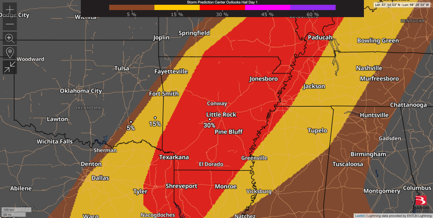
Here’s today’s Severe Risk Maps.


There’s an enhanced risk for severe weather Sunday, with most of it likely taking place during the evening.

Here are also some Flood Safety Awareness graphics from the NWS.


Here’s a look at the wind gusts from NWS and Earth Networks weather stations. My high wind gust was 35 on my Earth Networks weather station.
North Arkansas is showing Light Snow on radar. Anyone seeing any?


Here’s a look at the wind gusts from both NWS and Earth Networks weather stations across Arkansas.


The winds are still intense, and much of Arkansas is under a Fire Weather Warning (other parts of the state are still under a Wind Advisory).

Here are some radar images from the March 14, 2025 Severe Weather Event. The first is radar, second is Damaging Wind Path, third is Hail Path, and final is Rain Accumulations.
Here are two great Severe Weather Awareness graphics from the NWS I wanted to share with my readers!

